





Orono, United States
Emphasis is placed on developing novel concepts and methods in the broad field of geographic information science for sensing, storing, accessing, analyzing, and managing spatial data as well as modeling, extracting, integrating, visualizing, and communicating spatial information.;Students in the Spatial Information Science and Engineering program of The University of Maine build on a solid foundation in computer science, mathematics, physics, geography, cognitive science, artificial intelligence, engineering and related fields to study spatio-temporal phenomena and design intelligent spatial information systems. In addition to these concepts, the design of spatial information technologies requires a comprehensive understanding of the social, legal, economic, and institutional issues affecting such systems, a commitment to human users and ethical uses of such systems, dedication to the ethics of broad access to information, and commitment to quality of information.;I want to find another Master Course;The research interests of our faculty are currently predominantly in the area of Spatial Computing, including spatial cognition, spatio-temporal reasoning, geospatial ontologies, data streams, geosensor networks, spatial data science, and location privacy.;Objectives of these programs include:;The core objectives of the graduate programs include interdisciplinary study of the nature and function of spatial information systems, and the technical study of the design and evaluation of methods and processes to capture, represent and analyze spatial information.;Graduate courses cover formal representations of spatial phenomena, database systems, geographic information systems, human-centered design and information policy. Research topics may be selected from any of the principal areas ranging from geographic information science, spatial and spatio-temporal reasoning, spatial cognition and spatial interface design, spatial database systems, geosensor networks, to legal and managerial aspects of spatial information systems. Many research topics require an interdisciplinary approach and, therefore, courses taught in other departments complement the program offered.
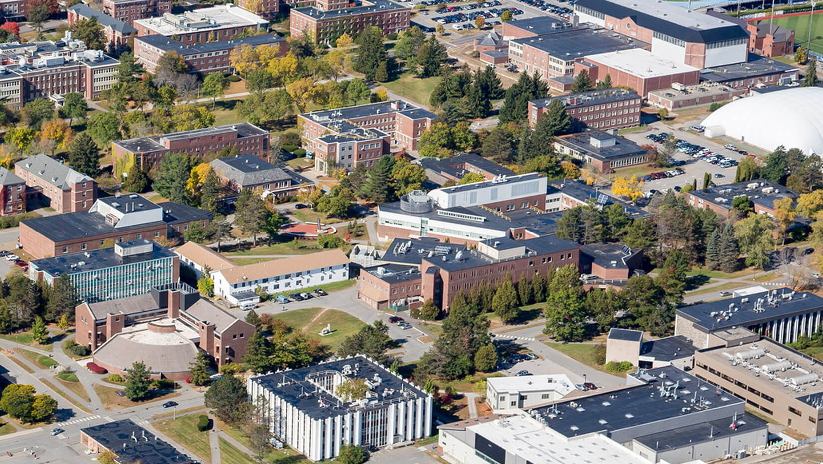
The University of Maine is a public research university founded in 1865 in Orono, Maine, and serves as the state's land-grant and flagship university. It enrolls approximately 11,000 students and its colleges include the Maine Business School and the College of Engineering. UMaine holds R1 research status, the only institution in the state to do so, and is particularly known for programs in engineering, marine sciences, and forestry, reflecting Maine's coastal and forest-based economy.

Don’t just apply; apply where you belong. Use GradRight’s AI platform to compare programs with other top-tier options based on real student outcomes, costs, and your unique profile.
Compare ProgramsAccess India’s first loan bidding marketplace to get competitive, low-interest education loan offers from 15+ top lenders, tailored to your aspirations.
Compare Loan OffersNavigate international health insurance requirements with ease. Get comprehensive, uni-compliant coverage that protects your health and your budget.
Check Insurance Plans
Don’t just apply; apply where you belong. Use GradRight’s AI platform to compare programs with other top-tier options based on real student outcomes, costs, and your unique profile.
Compare Programs
Access India’s first loan bidding marketplace to get competitive, low-interest education loan offers from 15+ top lenders, tailored to your aspirations.
Compare Loan Offers
Navigate international health insurance requirements with ease. Get comprehensive, uni-compliant coverage that protects your health and your budget.
Check Insurance PlansBased on current data, Spatial Information Science and Engineering at University of Maine has a total cost of ₹60,48,807 and an estimated ROI (including loan interest) of 90% over a 12-months program. University of Maine's median graduate package is ₹59,85,643.
University of Maine requires a minimum TOEFL iBT score of 80 or an IELTS score of 6.5, along with a GPA of 3.00. GRE is required (minimum score of 300) and GMAT is not specified for this program.

Trusted by 2,60,000+ students for their education abroad
 Australia +61
 Canada +1
 France +33
 Germany +49
 India +91
 Ireland +353
 UAE +971
 United Kingdom +44
 United States +1
By signing up, you agree to the Terms of Service and Data Processing Agreement
Enter the security code we sent to
By signing up, you agree to the Terms of Service and Data Processing Agreement